
UK Unveils New High-tech Interactive Campus Map
LEXINGTON, Ky. (Sept. 3, 2014) — Have you ever gotten lost on the University of Kentucky campus? Or, maybe started walking to your destination and realized it's taking longer than you thought? Maybe your GPS is no help because it's not updated for new construction on campus or you don't have a street address?
No worries. UK Facilities Information Services is unveiling its new state-of-the-art, interactive online campus map. It was developed to provide an array of services to users -- UK students, employees and visitors. With all the current construction on campus, the map quickly provides the most accurate information available.
Features include:
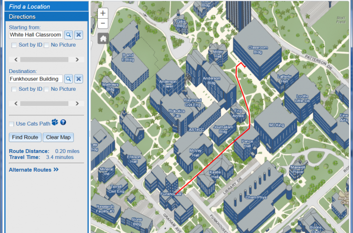
· finding most efficient walking routes from and to specific buildings on the map, including estimated travel times
· quick searches of buildings by name or academic area, parking locations, dining venues, residence halls, computing centers and dozens of other services on campus
· ability for users to create their own maps, print a copy, or embed it into their own website, eliminating the cost of mapmaking services
· information on various modes of transportation on campus
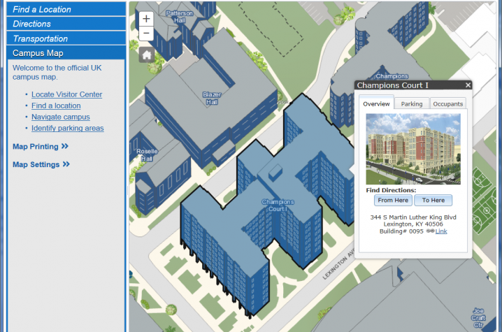
· photos and information of each building on the map including what units occupy the building
· multiple user-friendly map displays that show a perspective view of campus, building shape, depth and detail as well as annually flown high resolution aerial photography
· Google Street View 360 degree images of campus sidewalks
Andrew Blues, associate director of Facilities Information Services, said the latest geographic information system (GIS) technology is used in this map, making UK unique among universities offering this service.
“This is the university’s fastest and most advanced campus map to date," Blues said. "It builds a foundation to expand into many other areas of campus life.”
The map can be a useful tool to many people who are trying to navigate campus for many different reasons, said Michelle Ellington, GIS coordinator in Facilities Information Services.
“This map opens the door to unlimited and advanced campus routing capabilities," Ellington said. "It offers a wealth of information that tightly connects us to our campus, environment which adds value to the university experience.”
More features are expected to be added to the map later this fall. Become acquainted with the map at http://maps.uky.edu/campusmap/.