
Geological Survey Collaboration Studies Landslide Hazards in Kentucky
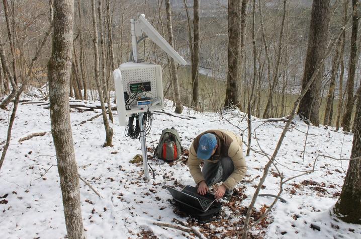
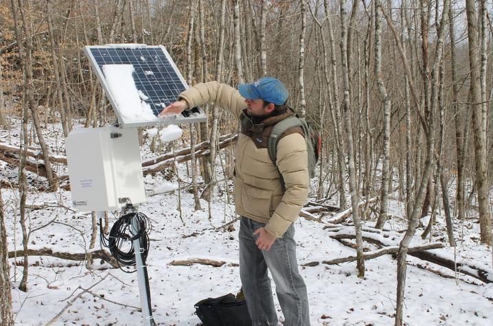
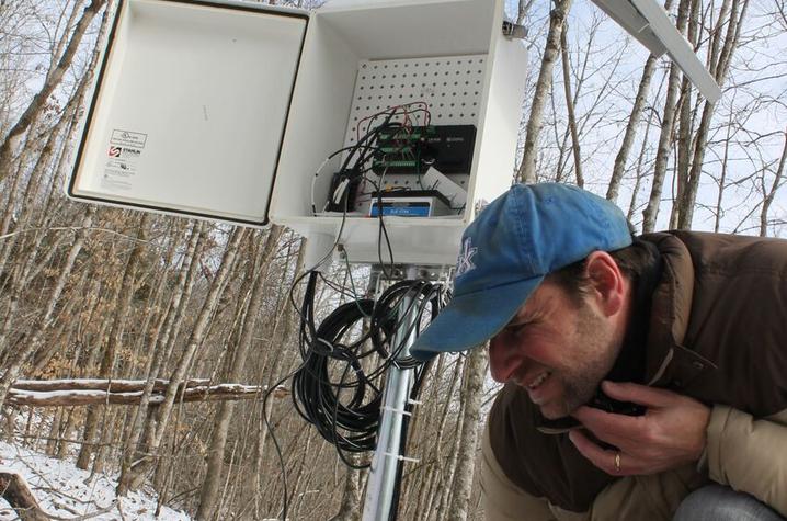
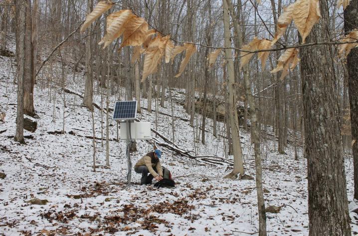
LEXINGTON, Ky. (Feb. 22, 2016) — On a sunny February afternoon, landslide researcher Matt Crawford brushes snow off the solar panels that charge batteries for a landslide monitoring site in the Daniel Boone National Forest. He connects his laptop to a data-logger below the solar panel to download information gathered by instruments since his last visit a month ago. This site on a wooded slope in Pulaski County has turned out to be a good one for the research by Crawford, who works at the Kentucky Geological Survey (KGS) on the University of Kentucky campus.
“It’s adjacent to a known landslide that has caused damage to several homes,” he said. “It’s accessible from the Forest Service road, and it’s not too steep. We can walk around the site and get work done.”
The monitoring site, on a slope above Lake Cumberland, is representative of the area’s terrain and shaly underlying bedrock geology, helping him to better understand landslide mechanisms in the region.
“If the lower area of the landslide near the lake moves a lot — and it doesn’t destroy our data-logger — capturing those rainfall and soil moisture conditions provides valuable information that we can apply to other locations.”
He and a U.S. Geological Survey (USGS) landslide researcher have collaborated to install instruments at the Pulaski County site to monitor conditions such as rainfall, soil water content, and the gradual movement of the slope.
“The instruments are getting a picture of the hydrologic behavior in the soil,” Crawford said. “If we look at the landslide movement over time, we can correlate that with particular times of saturated soil or even times of drier soil.”
In addition to the hydrologic monitoring, several geophysical surveys are being conducted to support the interpretation of the landslide mechanics. Specifically, measurements of the electrical resistivity of the soil are being used to detect excess moisture and clayey soil types, which are part of the conditions that lead to slope failure.
“Collaboration between the USGS and KGS also allows both agencies to stretch their limited research funds to conduct the monitoring,” said Crawford’s USGS research partner, Francis Ashland, of the USGS Landslide Hazards Program. “Both agencies shared the cost of the monitoring at the site, achieving together what may not have been possible on their own.”
Crawford has been studying landslides in many parts of Kentucky for several years to increase understanding of the mechanisms that cause hillsides to slowly creep downslope or occasionally slide suddenly. In either case, homes and buildings on the slopes, as well as streets and other infrastructure, may be damaged. Crawford has helped homeowners and communities apply for federal and state grant assistance in such cases by writing detailed reports on sites where homes have been damaged beyond repair by landslides. Homeowner’s insurance does not typically cover landslide losses.
Crawford’s research has shown that landslides and their effects are not inconsequential. With the help of state and local agencies, as well as reports from property owners, he has collected information on more than 2,500 Kentucky landslides, as well as about 75,000 landslides indicated on old maps. Information on the costs of landslide repairs to Kentucky’s roads and highways indicates that the annual costs of landslides in the state is at least $10 million. Crawford has set up two other monitoring stations at landslides in Kenton and Lewis counties. As the population increases toward landslide-prone areas, this research can benefit geologists, engineers, local officials, and planners in communities interested in assessing landslide hazard and risk.
In addition, Ashland said other research suggests climatic variability may be affecting natural hazards in the eastern U.S. “Since 2010, a combination of severe storms and above-average wet seasons has caused widespread and numerous landslides in the region,” according to Ashland.
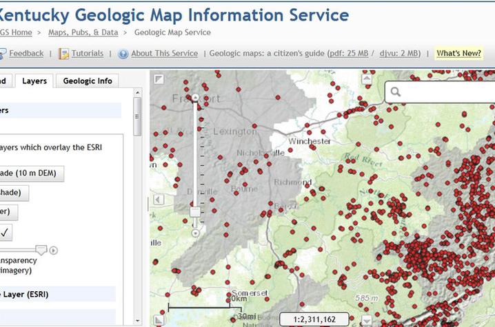
Find out more about landslides in Kentucky from the KGS landslide hazards page here. The page includes an interactive landslides map on which information about each mapped location is available by clicking on the different landslide features.
MEDIA CONTACT: Whitney Harder, 859-323-2396, whitney.harder@uky.edu