
Facilities VP Receives International Award
LEXINGTON, Ky. (Nov. 28, 2012) — Success could be defined as knowing where you are and where you want to go. It’s especially true if you are in unfamiliar territory without a map.
Every November, a day during Geography Awareness Week is set aside at the University of Kentucky to celebrate geographic information systems, GIS Day. At UK Facilities Management, the day is used to raise awareness of geographic information systems and to eat cake in celebration of the department’s GIS achievements. But these are no ordinary cakes; they are specially designed by creative staff members. Previous cake designs have included a three-dimensional campus, floor plan analysis, a GIS application on computer and keyboard cake, and a techy USB dongle (a hardware security device). See them all here: http://gisday.uky.edu/cakes.htm.
But of all those earlier cakes, this year’s cake was particularly special. It celebrated the third Special Achievement in GIS Award that Facilities Management has received at the annual Esri International User Conference. This year, UK was recognized for the collection of GIS solutions that Facilities Management has implemented across the campus, including campus and visitor maps, space-planning maps, parking and transportation maps and UK HealthCare interior maps.
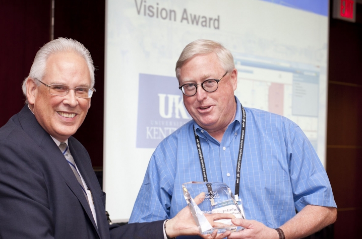
But before officially accepting UK’s 2012 International SAG Award, Bob Wiseman, UK vice president for facilities management, was surprised by being presented with an International Vision Award for the department’s early adoption of GIS as an interior space management solution during occupancy of UK HealthCare’s Pavilion A.
“With a technically advanced hospital we needed to provide a cutting edge system, and GIS allowed us to meet that challenge,” said Andrew Blues, UK Facilities Management’s information technology manager. Blues and Wiseman were co-presenters of a technical workshop at the international conference.
Michelle Ellington, UK GIS coordinator, also accepted the award for Best Web Application.
“The GIS team and I are really proud of our accomplishments on campus with our GIS products and being selected by our peers around the state was a real honor for us,” said Ellington.
“With GIS we are able to integrate students into our projects from a variety of majors, it is not just for geography students anymore,” said Wiseman.
For example, the current campus map now featured on UK’s homepage has a new default look showing a building’s height perspective, known as 2.5D or perspective view. Most of these buildings were created by civil engineering students.
“We’ve worked with students from architecture, chemical and civil engineering, geography and computer science,” said Ellington. “I see GIS growing across even more majors in the future. We had a photo journalism student who helped integrate 360-degree photos with our GIS.”
In addition to working with students, Facilities Management also supports faculty and staff with their role as UK GIS campus administrator of the Kentucky statewide Esri GIS license.
“We are continuing to expand the resources available to the UK community on the UK GIS Campus Support website http://maps.uky.edu/support/, and we have hundreds of training videos, rich data datasets plus a variety of other resources which are all free for campus use but much too large to fit on a cake!” Ellington said.