KGS receives federal grant to collect hazards data, improve future hazards mitigation

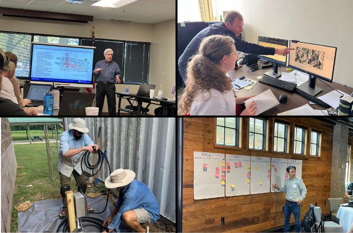
LEXINGTON, Ky. (Nov. 13, 2024) — The Kentucky Geological Survey (KGS) received funding from the Federal Emergency Management Agency’s (FEMA) Hazard Mitigation Grant program to support four hazard-related projects in Kentucky.
The first two-year project, awarded $98,057, will augment the existing KGS landslide inventory database. Matt Crawford, Ph.D., principal investigator (PI) and landslide geologist, will collect data to establish the link between known landslide occurrences and particular storm events. This link will allow researchers to evaluate seasonal trends and rainfall thresholds related to slope failure.
“We’ve seen extreme rainfall trigger Kentucky landslides,” said Crawford. “This funding will allow us to update our landslide inventory database and help stakeholders make better hazard mitigation decisions based on the new information.”
For the second part of this project, geologist Evelyn Bibbins will add to the existing inventory by mapping previously undocumented landslides using airborne light detection and ranging (lidar), as well as conducting elevation differencing between two sets of lidar.
The next project received $308,323 to support research that will enhance a karst/sinkhole hazard mitigation plan for the Barren River Area Development District (BRADD). Junfeng Zhu, Ph.D., PI and KGS hydrogeologist, will use existing sinkhole, geology formation, karst potential and high-resolution lidar data to improve sinkhole data accuracy and assess sinkhole hazards.
“We hope that this new information will result in a more systematic risk and vulnerability assessment for karst and sinkholes,” Zhu said. “Improved data on existing and new sinkholes is critical for hazard evaluation, mitigation and, ultimately, risk reduction in both BRADD and the Commonwealth of Kentucky.”
Similarly, the third project aims to address a critical information and data gap in flood hazard planning and mitigation efforts in the Inner Bluegrass region of Kentucky. Charles Taylor, PI, hydrogeologist and the KGS Water Resources Section head, leads this three-year, $218,887 project, to identify areas of higher potential vulnerability to karst sinkhole and groundwater-induced flooding. The project will implement advanced GIS terrain modeling and watershed delineation techniques to process high-resolution lidar topographic and sinkhole location data.
“This funding will really fill a gap in the current data,” emphasized Taylor. “Groundwater and surface water are highly interconnected in most parts of the Inner Bluegrass region and the role that karst plays in flood occurrence and severity has not been widely recognized or studied here. So, this is an opportunity to greatly improve our understanding of karst as a flood hazard and map potential vulnerabilities of sinkhole and sinking stream catchments to groundwater-induced flooding.”
The fourth project is led by Seth Carpenter, Ph.D., PI and seismologist in the KGS hazards section. This three-year project was awarded $191,930 to identify seismic and infrasonic signals that a tornado generates while on the ground and to assess the feasibility of using real-time data to improve tornado warning systems. The project will use existing seismic recordings from the Kentucky Seismic and Strong Motion Network.
“After the devastating Western Kentucky storm system in December 2021 produced multiple tornadoes that caused great loss of life and property, we hope this research not only improves tornado warnings systems, but also assists with tornado risk reduction in Kentucky,” said Carpenter.
Combined, the four projects highlight the research being done by KGS to help address Kentucky hazards and inform mitigation decisions.
Federal Emergency Management Agency’s (FEMA) Hazard Mitigation Grants were received through the Kentucky Department of Military Affairs and the Kentucky Division of Emergency Management.”
As the state’s flagship, land-grant institution, the University of Kentucky exists to advance the Commonwealth. We do that by preparing the next generation of leaders — placing students at the heart of everything we do — and transforming the lives of Kentuckians through education, research and creative work, service and health care. We pride ourselves on being a catalyst for breakthroughs and a force for healing, a place where ingenuity unfolds. It's all made possible by our people — visionaries, disruptors and pioneers — who make up 200 academic programs, a $476.5 million research and development enterprise and a world-class medical center, all on one campus.


